Trou du Souffleur hike and the Douaniers path
Last update: 06/24/2026
Our blog continues to grow thanks to you, our readers. This post may contain affiliate links, which means we can earn a small commission if you make a purchase through them, at no extra cost to you. This helps us to continue to bring you more and support our work!
We spent a long weekend exploring northern Grande-Terre, as we mentioned in our article about discovering Anse Castalia. After two years of living in Guadeloupe, we were eager to cover more of the island on the blog. Since we live at the opposite end of Guadeloupe and Anse-Bertrand is a long drive from home, we prefer to spend several days exploring one area at a time.
Continuing our exploration of northern Grande-Terre, today we’re sharing our hike to Trou du Souffleur along the Douaniers path, part of the coastal trail that follows the northeastern cliffs of Grande-Terre.

To be honest, this was our second attempt at the hike. The first time, we went with Mélanie’s father, started too late, and quickly turned back because there was almost no shade. This time, we made it as far as we had planned. Here is the full story, with plenty of photos.
Discovering the Trace des Falaises, Trou du Souffleur, and Pointe du Souffleur
We were determined not to repeat our previous mistake. We arrived at 9 a.m., though in hindsight that was still a little late if the goal was to avoid the heat. We were staying about thirty minutes away, but starting around 8 a.m.—or even earlier if you are nearby—would be much better.
We parked in the lot opposite Porte d’Enfer, on the other side of the road. Since it was a weekday and still fairly early, only two other cars were there. I imagine the lot fills quickly during the high season and on weekends. We got the children ready and started walking at around 9 a.m. I had not checked the distance beforehand—which is unlike me, haha—and soon realized this was not such a short outing after all.

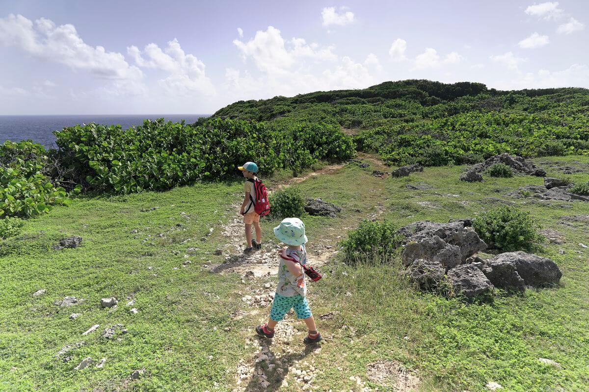
The weather was clear, promising broad views from the cliffside trail. Several routes can lead toward Trou du Souffleur, but Porte d’Enfer is the most logical starting point if you want to follow the Trace des Falaises—or at least the coastal section we describe here.
Cross the road, pass the small wooden hut, and follow the boardwalk down toward the beach. We were pleasantly surprised because this natural inlet is often covered in sargassum. That had been the case on my previous visit, when the smell was overwhelming. Conditions were much better this time, although the seaweed and cloudy water still made the beach look less inviting for swimming.

We stepped across the small channel and continued along the narrow inlet stretching inland. It is a striking place and unlike anywhere else I know in Guadeloupe. With a little imagination, it almost feels like a tropical fjord—although it was already around 35°C and we were surrounded by wildflowers and tropical vegetation, haha.
The first part of the walk follows the shoreline and opens onto impressive limestone cliffs. There is also a viewpoint above the cliffs that can be reached by car. Along the inlet, you will find a few benches that make a good place to stop for a picnic on the way back.
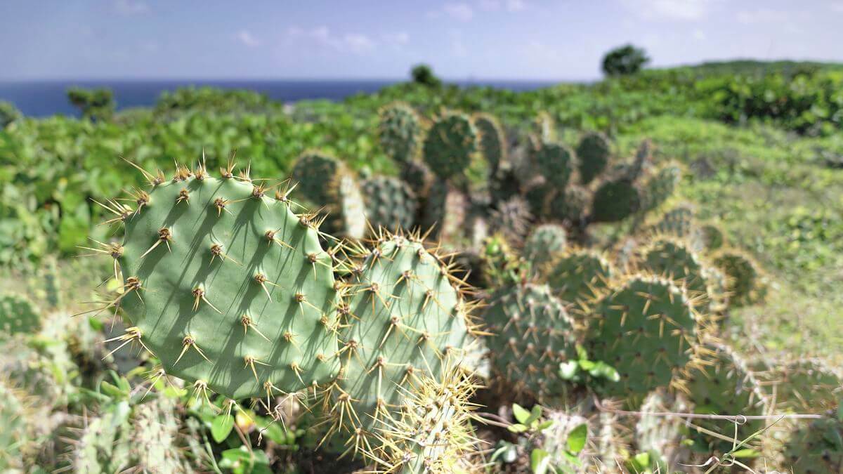
The main trail then climbs above the sea and follows the limestone cliffs. To the left, the Piton cliffs and Pointe du Piton are especially photogenic. Farther on, you get wide views of the rocky coast and the Atlantic swell hitting the shore. Keep in mind that there are no beaches along this section where you can stop for a swim. The changing cliff scenery is the main attraction.
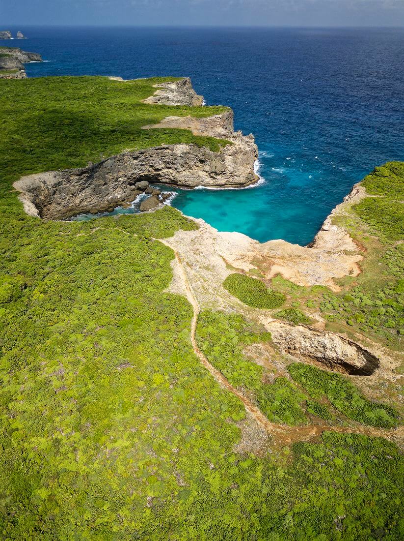

The cliffside trail is very pleasant, but the heat was already intense at 9 a.m., so the sea breeze was welcome. The route alternates between exposed, windswept cliffs and short stretches of shaded woodland.
The terrain is not especially steep and feels very different from the mountain hikes on Basse-Terre. Even so, you need to watch your footing on the rough limestone and stay well away from the cliff edges. Along the way, you pass viewpoints toward Trou Madame Coco, Pointe Percée, Accul à Desbonnes, Anse Belle Rose, Pointe à Desbonnes, Pointe à Tortues, and Accul à Tortue.
Despite the relatively gentle elevation profile, the heat makes the walk physically demanding. Shade is scarce, and heat exhaustion is a genuine risk. Louis managed without any trouble, but Téo was tired after about a kilometer and a half. Guess who had to carry him on his shoulders while also wearing a backpack? Add my camera bag, which weighed seven or eight kilos, and I was carrying close to twenty kilos—not exactly a relaxing stroll, haha!


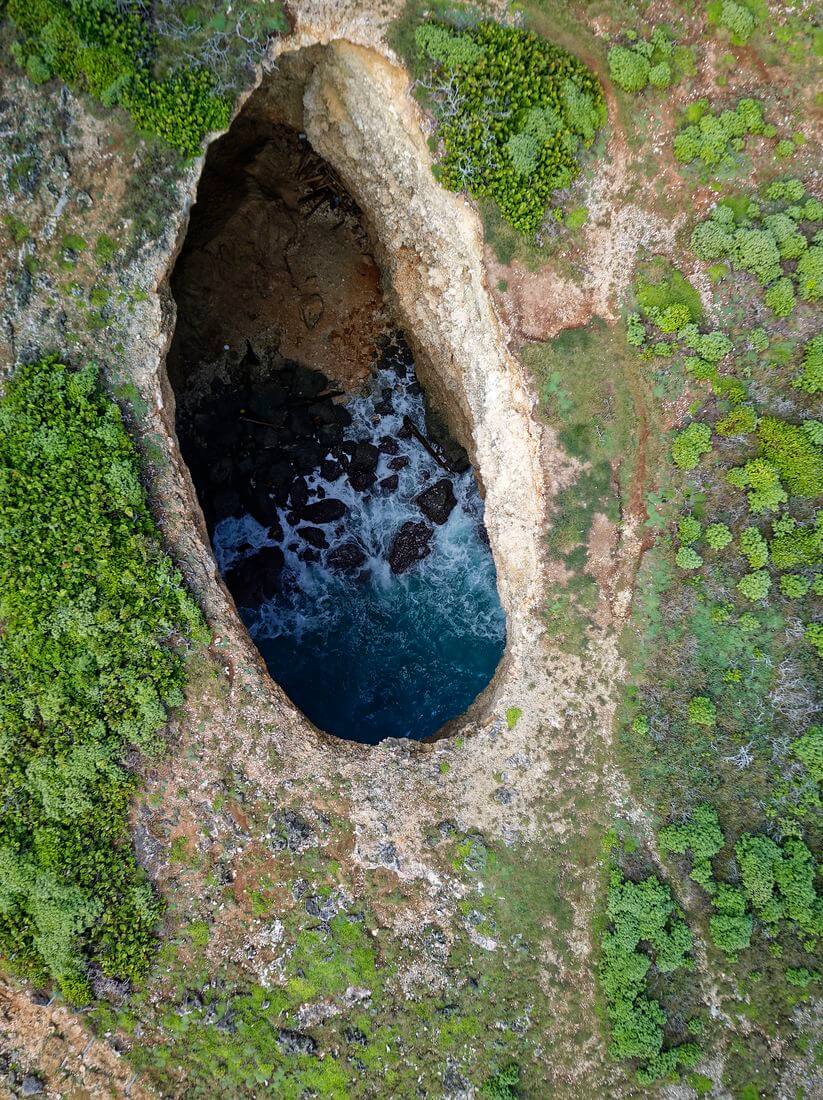
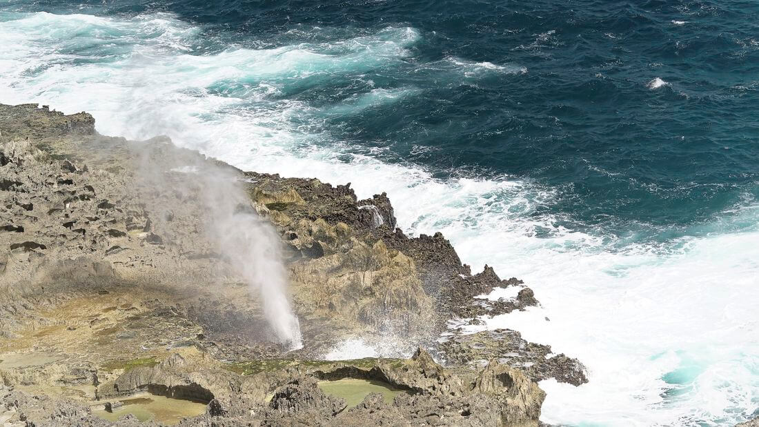
We walked slowly with the children and took plenty of breaks. After about an hour and a half, we reached Trou du Souffleur near Pointe à Tortue. It is a large blowhole in the limestone, somewhat like the one on Marie-Galante but smaller. Barriers prevent visitors from getting too close, which is important because the edges can collapse. Mélanie flew her drone, giving us a better view of the formation. It is interesting, though I found the surrounding coastline even more impressive than the blowhole itself.

We continued under the blazing sun and reached Pointe du Souffleur roughly two hours after starting. Shortly before the point, the natural arches came into view. They are among the most beautiful features of the route. The rocky headlands and small coves are equally attractive, with turquoise water below the cliffs. Clear weather makes a real difference here, as the colors are much less striking under a gray sky.
At Pointe du Souffleur, we stopped for about half an hour to enjoy the scenery and watch the waves crash against the limestone. At times, you can even feel the spray and air forced through the rocks. The children were tiring quickly, so we returned at a faster pace. Louis kept going without complaint, but Téo was too tired to walk and I carried him on my shoulders the entire way back. Needless to say, I was exhausted by the finish. The return from Pointe du Souffleur to the parking lot took us exactly one hour without any real stops—about four kilometers.

Our out-and-back walk totaled almost eight kilometers. The official Trace des Falaises continues from Pointe du Souffleur to La Mahaudière. The full route is an 11.7-kilometer one-way hike, so completing it requires planning transportation at the far end or arranging a second vehicle.
Overall, the landscape makes a refreshing change from the dense forest and steep slopes of Basse-Terre. The walk is enjoyable, although some stretches can feel repetitive. The biggest issue is the lack of shade. Families with young children need to be especially cautious, as the heat can make the route far more demanding than the relatively flat terrain suggests. This is not a short outing. Bringing a picnic and stopping at the benches beside the inlet on the way back would be a good way to finish the day.


Trou du Souffleur: practical information
Here is what you need to know before hiking the Trace des Falaises via Trou du Souffleur.
Where to start the hike?
As always, start with our detailed article on how to get to Guadeloupe. Once on the island, renting a car is the easiest way to explore independently. We often recommend comparing rates through DiscoverCars, which lists offers from several rental companies.
The trail is in northern Grande-Terre, in the commune of Anse-Bertrand. The official route runs one way from Porte d’Enfer to La Mahaudière, but our outing was an out-and-back walk from Porte d’Enfer. Here are the routes from Pointe-à-Pitre to Porte d’Enfer and to La Mahaudière.
The official trail is marked in yellow and with CANGT-logo posts. Do not rely on informal shortcuts shown online or on mapping apps, as they may be less clear or cross more fragile terrain. Most importantly, stay well back from the cliff edges and Trou du Souffleur because of the risk of collapse.
Where to stay nearby?
We stayed in Le Moule because it offered a fairly central base. Our accommodation was “Ti Cocoon”, which offered good value for money. It is worth considering if you want to explore the surrounding area.
For somewhere closer to the trail, here are a few options:
- Gîtes Les Bienheureux: an attractive house known for its warm welcome.
- Kaz à Klemence: an accommodation that receives positive feedback.
- Another option is this well-equipped small house in a natural setting.
What to do in the area?
Here are a few ideas for other things to see and do nearby:
- Enjoy the beaches along the western coast for a swim or sunset, including Plage de la Chapelle, Anse Laborde, and Anse du Souffleur.
- Explore Anse Castalia to the northwest.
- Visit the Marches des Esclaves in Petit-Canal.
That is everything you need to know about our walk to Trou du Souffleur along the Trace des Falaises.
See you soon for another article. You can also visit our page featuring all the hikes in Guadeloupe we have completed since moving here!

Written by Sylvain PONS
Since 2021, I've been living in the Guadeloupe archipelago with Mélanie and our two children. We are exploring these beautiful islands and discovering the treasures that we are happy to share with you!
Despite our care, a mistake may have slipped into this article. If you find any, please don't hesitate to let us know so we can correct it as soon as possible and keep our information up-to-date!