Vaitavere hike in Punaauia
Last update: 06/05/2026
Our blog continues to grow thanks to you, our readers. This post may contain affiliate links, which means we can earn a small commission if you make a purchase through them, at no extra cost to you. This helps us to continue to bring you more and support our work!
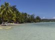
It took almost 6 years of life in French Polynesia to write an article about a hike in Tahiti. I’m almost ashamed of it…And yet, the circumstances are peculiar, after all. We just officially announced that we are leaving the territory at the beginning of August 2021 and we have been welcoming Guillaume, Mélanie’s brother, during these last three weeks. I had already written a complete article on things to do in Tahiti (enjoy sandy beaches, waterfalls and lagoons, do snorkeling, do scuba diving, do canoe-kayak and many others activities in this paradise), but for the time being, I hadn’t specifically recommended hiking.
Why is that, might you ask? I’m not sure. I love walking, Melanie much less, especially when it is steep. And then, with the arrival of two children and life taking over, we focused much more on the sea than on the land, these last years. Anyway, I’m rambling. Today, after showing you the beautiful landscapes we could encounter on the island of Tahiti, in our Instagram story, I decided to write this little article about the Vaitavere hike, on the heights of Punaauia, here on the island of Tahiti.
If you are looking for outdoor activities in the area during your polynesian road-trip, I have 3 recommendations not far from there! I’ll tell you about them at the end of the article.

Are you planning your trip to French Polynesia?
We decided to make your life easier by creating our own travel guide, where everything is organized, categorized, and summarized. Save research time and start traveling already!
Yes, I'm interested!
Clearly, I will not have the possibility nor the time to write a complete article about hiking in Tahiti. I haven’t done enough of it, and I don’t have a clear understanding of the subject. However, we have to face the fact that the vast majority of people who visit French Polynesia do not stay on the island of Tahiti during their vacations. The few who remain will not necessarily take the time to discover the interior of the island. And I must admit that writing articles that nobody will read, or almost nobody, is not very motivating!
However, after our story and Facebook page shares, many of you have congratulated us for the pictures and asked us for information about the hike. So, I thought it was worth writing a short article to tell you about it and everything you need to know to enjoy this hike!

I will first write about the walk. Then, as usual, you will find the hike’s practical aspects at the end of the article.

Walking in Vaitavere
I don’t know if we should talk about a walk or a hike but considering the positive difference in altitude and the pain in my legs and adductors I felt the next morning, I’d rather talk about a hike, lol! Well, first things first. You can start this hike from at least two points, the Vaitavere cemetery or the Stunn’Inn View buildings, at the top of the Punavai Nui residential area. I’ll tell you more about this in the practical section.
In short, if you decide to start from the cemetery, there are really two parts to the Vaitavere hike. The first part which goes from the main road down to the cemetery is entirely paved. Let’s say right away that, in my humble opinion, the interest of walking on a concrete road for about 30/40 minutes -depending on your level- is more than limited. People often come here to do sports, cardio, etc. In such a case, you will have good reasons to start walking from the bottom. If you are here to enjoy the landscapes, a walk in nature, listen to birds flying, etc, you can skip this part which does not present any interest, except for burning your calves and your heart out because it is a very steepclimb!


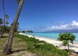
Anyway, we park in front of the cemetery at 8 am, at an altitude of about 320 m. It’s not too hot yet and there don’t seem to be too many people. That’ s also the advantage when you have people coming over such as family and friends. We do different things and change our daily life such as doing things we never took the time to do during the past 6 years. We slowly start, the beginning of this hike, with the shade, on a wide dirt road. No big difficulty encountered at the beginning of the hike, I must say. We also cross fields of pineapples where we can already see the magnificent panoramas offered by the island of Moorea, located just in front of us. The weather is good and the breathtaking view on the turquoise lagoon, the marina Taina of Punaauia, and the island of Moorea, is already splendid.
Starting from this end of the hike, the path is really wide since it is the one used by 4×4 cars dropping paragliders on the platform located higher. The path, cut through a vegetation essentially made of ferns, and pines in the lower part, is globally quite easy and offers gorgeous panoramic views throughout. There are, however, some rather steep portions. If you sometimes turn around while hiking, you will always have the same view over Moorea and the Tahitian lagoon. The view changes from time to time and the higher you go, the more spectacular the view becomes.


The last but rather steep slope allows you to reach the ” 850m altitude milestone” situated next to a small hut. We take the time to rest for a small quarter of an hour, in the shade, and take advantage of the view. Note that photography lovers will find there a lot of small flowers and ferns of all shapes and sizes to shoot. After walking for about 1 hour at an easy pace and stopping to take pictures, the short break feels good. Indeed, it is also a chance to test my new Sony A7 III camera and the new wide-angle lens I just received. One last effort allows us to reach the famous paragliders’ platform. The panorama is superb, the weather still beautiful, we enjoy ourselves.
We decide to keep on going and follow the path, something that few people seem to do for sure. To begin with, the path is still as wide but narrows little by little as we progress. At the end of our stroll, we walk on a wet path. The vegetation changed here, and we find ourselves in a forest of small bushes covered in moss. I must say that at this altitude, it must rain much more than on the lowland. On the way, we stop to take some pictures in a recess which offers a beautiful view of the valley of Punaruu’s cliffs. The view is still sublime. We finish today’s hike with a stop on a platform, around 1000 m high. The plunging views on both the valley and the orange trees’ plateau are superb and, frankly, it is a pleasure to be there. I realize (it’s never too late, isn’t it?) that it’s really worth going to walk deep in the islands of the tropics… Anyway, it was already quite late and we had a lot of things to do with our house move. We were almost at the end. With hindsight, we should have walked 15 minutes further up the path…


We hike back down quite easily in less than an hour, even if the way down hurts our legs. Personally, we really enjoyed ourselves and it really was a nice hike.
What to do around Vaitavere?
Maybe you’re looking for activities around Vaitavere? There are plenty of things to do and consider on your vacation in the area. I’ve selected 3 cool activities to do around it!


- Paragliding : By choosing to fly over the area by paraglider, you will even have the opportunity to see the Vaitavere hike from the sky, Punaauia lagoon and much more!
- First dive : It could also be the opportunity to try a dive in the lagoon of Tahiti, right?
- A few hours of jet skiing : Discover Tahiti's lagoon for a few hours with a guide!
Practical information - Vaitavere Hike
As I said at the beginning of this article, here are a few things you need to know about this hike in Punaauia. The round trip distance from the starting point to the paragliding platform: 6 km. Allow about 2 hours for the return, depending on your ability.
How to get to Vaitavere?
The hike is located on the heights of the city of Punaauia (next to the Pacific Ocean), on the island of Tahiti. Locals know the place. If you want to plan this hike from France, you will obviously have to come here first. As often, I recommend the flight comparator Skyscanner which I have used for many years to find the best flights.
Once there, if you are on vacation, you will have to rent a car to get around. In any case, a car will be necessary to go around the island of Tahiti for 1 or 2 days. I recommend this very good website to check and compare prices with different rental companies.
To get there, you will have to drive towards the west coast, past the town of Punaauia until the Mil’ Délices roundabout. From there you have two possibilities:
- Start the hike from Vaitavere’s cemetery (what we did). In this case, you just have to go around the roundabout and follow the small road which goes along the main road. Access to the road is 500 m on your right. You will see the Vaitavere sign on your right and you just have to go up to the cemetery. The hike starts here. Here are the directions from Papeete on Google Map.
- You can also choose to go up the top of Punavai Nui at the Stunn’Iinn View residence. Here is the route on Google Map.

Where do you start the hike from Vaitavere?
It all depends on what you prefer, I think. Most people should start their expedition at the cemetery, but you should know that you will start from a lower point (about 360 m). If you decide to start from the Stunn’Iinn View residence, you will be gaining a little bit in terms of altitude (about 420 m). From what I could see however, the hike starts on a small path in the ferns and follows the ridge.
Note that both paths merge in any case, before reaching the paragliders’ platform.
How do you find your way around Vaitavere?
You really won’t get lost on the hike during your day-trip. You can use the Maps.me aps which I often use when I travel to find my itineraries easily. It is, in my opinion, the best (offline) application you should download on your smartphone.
Otherwise, you can look at the tracks on the wikilocs’ website. From the cemetery, it’s this way.
That’s it, I’m coming to the end of this short article about the Vaitavere hike. It is a very nice walk to have, whether you live here or are on vacation on the island of Tahiti. It is a great opportunity to discover the beauty of the interior of Tahiti which puts on quite a show.
If you are visiting the polynesian island of Tahiti, don’t forget to visit the market in Papeete.
See you soon,
Sylvain

Written by Sylvain PONS
From 2015 to 2021, French Polynesia was our home, with Mélanie and our children. I'm happy to share my experience and advice to help you organize an unforgettable stay in French Polynesia, based on my in-depth knowledge of the territory.
Despite our care, a mistake may have slipped into this article. If you find any, please don't hesitate to let us know so we can correct it as soon as possible and keep our information up-to-date!