Hiking to Saut du Bras du Fort in Goyave
Last update: 06/24/2026
Our blog continues to grow thanks to you, our readers. This post may contain affiliate links, which means we can earn a small commission if you make a purchase through them, at no extra cost to you. This helps us to continue to bring you more and support our work!
We are continuing to explore Guadeloupe, especially Basse-Terre, the island we call home. As you may already know, we left French Polynesia and the Pacific in early August 2021 and moved to the Caribbean island of Guadeloupe. Once lockdown ended, we were finally able to venture farther from home. After taking you along the Sentier de la Grande Pointe in our previous article, today we are heading to another small natural site: Saut du Bras du Fort in Goyave.
I should admit that I did this hike alone. Mélanie and the children were tired after several busy weeks spent exploring for the Guadeloupe section of the blog. I am sure they will soon be back on their feet, though, and the four of us will return to the island’s trails. We have also made a few more discoveries since our hike to Bis Waterfall.


To be honest, I had never heard of this walk before coming across it online. While researching new places for the Guadeloupe section of the blog, its name kept appearing, so one Sunday morning I decided to explore it on my own.
You will find all the details in the practical section at the end of the article. For now, just know that the trail begins near the town of Goyave, on the east coast of Basse-Terre. There are plenty of other hikes in the area, but time has become harder to find since I went back to work. You could also consider the walk to Saut de la Lézarde, an unofficial trail leading to another beautiful waterfall.
Let’s set off on the Bras du Fort trail. The hike has three distinct sections: an agricultural track at the start, a forest trail in the middle, and finally a walk upstream through the river to the waterfall. Enjoy the journey. For something more physically demanding, take a look at Canyon de la Moustique.
Hiking to Saut du Bras du Fort
After driving for about half an hour from Vieux-Fort in the south, I left the N1 and headed west toward the hamlets of Barthélémy and then Bonfils. I will give you the exact route below, but this is where the walk begins. There is an open area on the left where hikers park. I am not entirely sure it is an official parking lot, but I had been told that leaving a car there was generally accepted.

I parked, picked up my camera bag and tripod for some long-exposure shots, and followed the small track toward the forest in the quiet of the morning. The sun was out, and the conditions looked good. The well-maintained path passes porcelain roses and plenty of epiphytic plants, which have become a familiar sight since moving to Guadeloupe. Plantations line both sides before the trail enters the forest. Look closely and you may spot breadfruit trees, coconut palms, banana plants, sugarcane, and more. About 150 meters from the start, keep left. Just before the hike’s only short climb, the trail reaches a Y-junction. The path on the left descends directly to the Rivière du Fort. You can take it to avoid the brief but slippery climb and descent, or use it as an alternative on the way back.


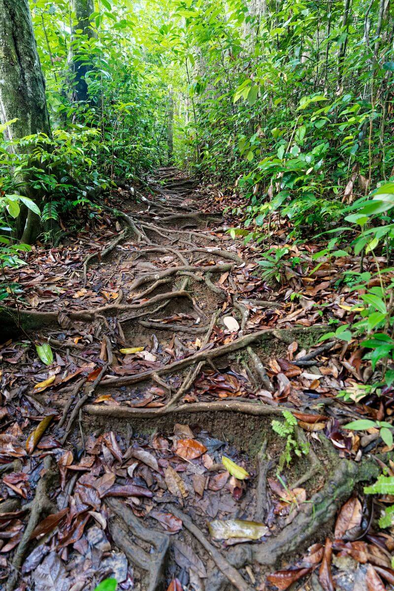
I stayed on the main path to the right and began the short climb. It is not especially difficult and takes only about five minutes, although the slope is steep enough that the surrounding roots can be useful for support. A few minutes later, I reached a small plateau in the middle of the forest. The humidity was immediately noticeable, and dead tree stumps were covered with mushrooms. I planned to ask my father about them a few weeks later because they looked remarkably similar to the mushrooms I used to gather in southern France. I was not going to take any chances, however; wild mushrooms should never be eaten without reliable identification. The descent is much like the climb: steep, slippery, and very short.


At the bottom, I reached the Rivière du Fort, which gives the walk its name. The setting was beautiful: I was alone beside the river in the middle of the forest, with nothing to hear except birds and what sounded like crickets. The atmosphere was wonderfully peaceful, and by the end of the hike I wished Mélanie and the children had come along because the route had proved fairly manageable in those conditions. The previous day, we had attempted a poorly marked, slippery trail that felt far less suitable for children and eventually turned back. I may write about it if I return alone.
I used the moment to set up my tripod, attach a polarizing filter, and take a few photographs. From the river, the route continues upstream along the riverbed. The direction felt obvious during my visit, but river conditions and informal paths can change. Do not enter this section during rain, after heavy rainfall, or whenever the water level or current looks uncertain. Much of the route follows sandbars, stones, and the river itself, so a sudden rise in water could quickly become dangerous.
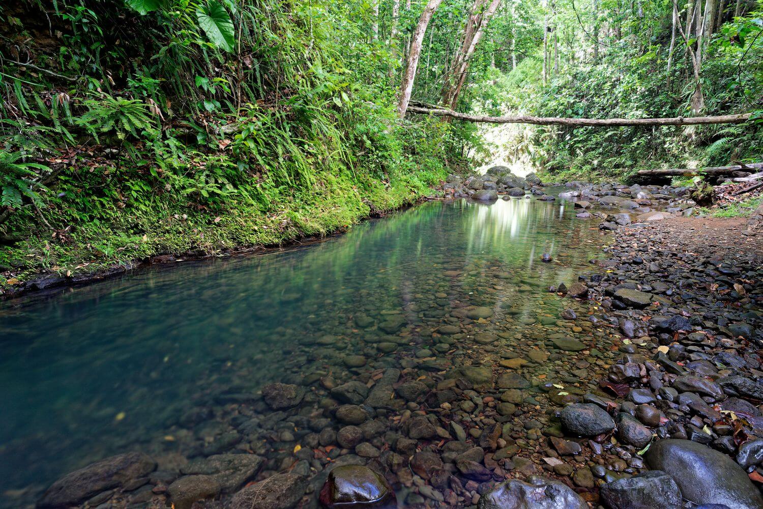

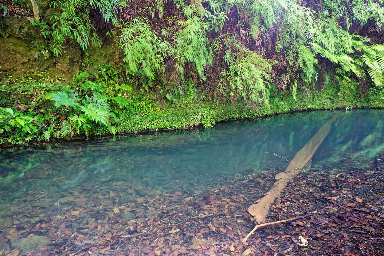
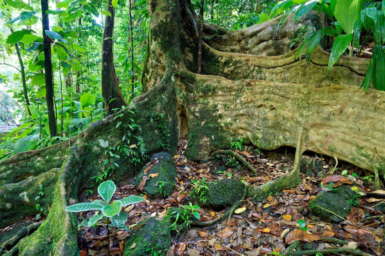
Walking upstream was very pleasant, with several naturally colored pools along the way. Some appeared shallow, although depth can be difficult to judge, and they photographed beautifully. I continued toward the waterfall, which was roughly another 20 minutes away. Just before reaching it, I passed an enormous Acomat Boucan, its huge roots and buttresses as impressive as ever.

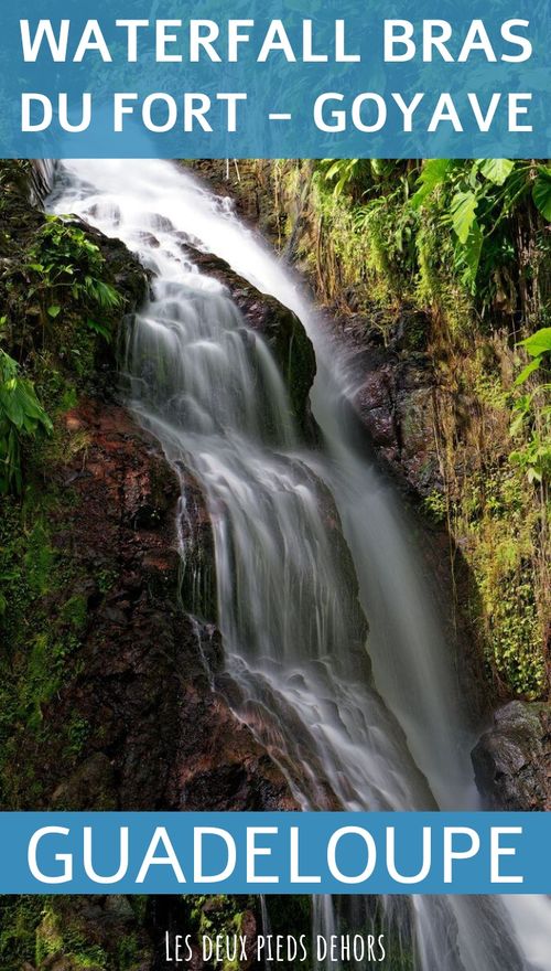
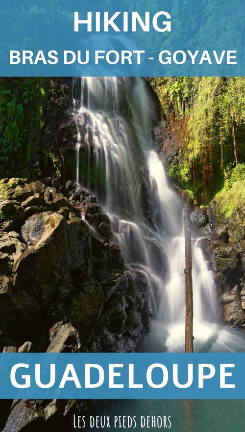
The sound of the waterfall grew louder as I approached. At the end of the valley, the trail finally revealed its reward: the waterfall and a natural pool at its base. It looked inviting for a swim, although the water was too cold for me. I stopped to photograph the falls from below, but the contrast between the shaded rocks around the pool and the sunlit water made the exposure difficult.

The setting was even more enjoyable with nobody else around, and arriving early certainly helped. I climbed carefully over the rocks on the right to take a few closer photographs. Both the roar and the volume of water were striking. I spent about half an hour shooting long exposures beside the falls, taking particular care on the extremely slippery rocks. Falling into the pool with all my camera equipment would not have ended well.


The return is not especially complicated, but I had read that it was possible to avoid the steep climb and descent by continuing farther downstream. I tried that option instead of retracing the original trail. Honestly, I am not convinced it is better. It is longer, walking over loose stones is tiring, and depending on the water level you may have to wade. I also found this section less attractive than the stretch leading to the waterfall. After roughly 15 to 20 minutes, a path on the left led back toward the foot of the original climb and rejoined the route mentioned earlier.
That brings this short account to an end. I hope you enjoyed it. The walk can be suitable for families in dry, stable conditions, but the slippery forest section, river crossings, and possibility of rapidly rising water mean that adults should assess the route carefully before bringing children.
Saut du Bras du Fort at a glance
- Difficulty: Easy to moderate in dry conditions, with a short, steep, slippery climb and descent followed by walking in the riverbed. A guide is not normally required.
- Duration: Around 2 hours round trip, or closer to 3 hours with swimming and photography stops.
- Distance: Around 3 km round trip
- Route type: Out and back, with an optional riverbed variation for part of the return.
- Conditions: Go only in settled weather. Avoid the route during rain, after heavy rainfall, or when the river is high.
- Best time: Early in the morning, preferably during a drier spell.
- Bring: A rain jacket, hiking shoes with good grip, and mosquito repellent.
Below is an interactive map of the Bras du Fort hiking area, with both satellite imagery and the IGN map. You can also download the GPX track and import it into your GPS device or navigation app using the link below:
The map also shows the hikes we have completed or plan to explore in other parts of the island. We have gathered them on a dedicated page about hiking in Guadeloupe.
What else can you do nearby?
I did not know the surrounding area particularly well at the time, but my topographic map and the resources I consulted suggested several nearby places to explore:
- Chutes Moreau waterfalls,
- The Water Garden of Goyave,
- The Montebello Distillery,
- The visit of Valombreuse Garden,
- The Mamelles road, and so many discoveries on the road (Cascade aux écrevisses, Saut de la Lézarde, etc.).


Practical information
As usual, here is a summary of the practical information you need before setting out.
How do you get to Saut du Bras du Fort?
Most visitors arriving from mainland France fly to Guadeloupe, with Paris offering the widest range of services. Direct flights may also be available from cities such as Lyon or Bordeaux, depending on the season. Prices vary considerably with dates and demand, so compare current fares rather than relying on a fixed amount. You can find more details in our guide to getting to Guadeloupe.
We have used Skyscanner for years to compare fares and see which airlines serve a destination. It can also help identify less expensive travel periods. Airline schedules can change, so check the current options for your dates. Guadeloupe is too large to explore entirely on foot or by bicycle, and public transportation is limited for reaching trailheads, so renting a car is usually the most practical option.
Returning to the hike itself, the drive depends on where you are staying. From Grande-Terre, the trailhead is still reasonably accessible. Here is an itinerary from the airport. The route is roughly 30 km, but travel time depends heavily on traffic and current road conditions.
For navigation, the following tools may be useful:
Where should you stay near Bras du Fort?
As elsewhere in Guadeloupe, accommodation is available for a range of budgets and preferences. Here are a few ideas:
- Villa Palulie, a villa with a pool close to the trail,
- Le Bungalow Luxe la Créole – Habitation Saint Charles, a comfortable option in Petit-Bourg for relaxing after the hike,
- Les Gites de la Lézarde: a three-star property in a natural setting.
You can also look at all the accommodations near the city of Goyave.
That brings this account of Saut du Bras du Fort to an end. I hope you enjoyed it and found it useful. I found the setting peaceful, natural, and relatively accessible in the dry conditions I encountered. A picnic near the waterfall can be a lovely idea, provided you respect the site, carry out all waste, and remain alert to the weather and river level.
We will continue exploring Basse-Terre. At the time I wrote these lines, we were about to spend four days on Terre-de-Bas in Les Saintes, the archipelago just across from our home. For another waterfall walk, take a look at the Cascade du Paradis hike in Vieux-Habitants.
See you soon.

Written by Sylvain PONS
Since 2021, I've been living in the Guadeloupe archipelago with Mélanie and our two children. We are exploring these beautiful islands and discovering the treasures that we are happy to share with you!
Despite our care, a mistake may have slipped into this article. If you find any, please don't hesitate to let us know so we can correct it as soon as possible and keep our information up-to-date!