Hiking to Cascade du Paradis
Last update: 06/24/2026
Our blog continues to grow thanks to you, our readers. This post may contain affiliate links, which means we can earn a small commission if you make a purchase through them, at no extra cost to you. This helps us to continue to bring you more and support our work!
As I write this, it has been a month since we left French Polynesia and moved to Guadeloupe with our family. Little by little, we are getting to know this beautiful island. In our first article about Guadeloupe, we took you on the Bassin Bleu walk, in the hills above Gourbeyre on Basse-Terre. This week, we are heading out on another hike, this time to the famous Cascade du Paradis—Paradise Waterfall—in the commune of Vieux-Habitants.
When you arrive on an island you do not know yet, all you want to do is explore every little corner of it! So I started studying topographic maps and browsing the few websites devoted to walks on Basse-Terre. That is how I found this lovely family-friendly hike.


I have to admit that we did this hike twice. On our first attempt, we arrived very late in the afternoon and did not really have time to enjoy the scenery. We could only stay for a couple of minutes at the end of the trail before risking a return in the dark. Not very sensible, I know, especially with two young children. We made it back just before nightfall, practically at a run. To appreciate the walk properly, take in the local wildlife and plant life, and gather enough material for this blog post, we decided to return for a full day with a picnic. If you love plants and wildlife, consider visiting the beautiful Deshaies Botanical Garden in the northwest of the island. It is a real treat for the eyes.
The plan for the day was simple: an early start, a short drive, a pleasant family walk through another beautiful tropical setting, and, as the grand finale, a swim in a green pool glowing in the morning light. What more could we ask for?
One quick note: do not confuse this waterfall with Bassin Paradis. The names are similar, but Bassin Paradis is near the Carbet Falls, in the commune of Capesterre-Belle-Eau.
Farther north, in Bouillante, you can also visit Parc de la Source.
Hiking to Cascade du Paradis in Vieux-Habitants
The trailhead is not especially close to where we are staying while we look for a more permanent home in Guadeloupe. At the time of writing, we are living in the hills above Saint-Claude, while the hike begins near Vieux-Habitants. After preparing our picnic for the day, we leave our Airbnb early and set off. As always, you will find all the practical information you need about this forest hike at the end of the article. After about a 20-minute drive toward the west coast, we reach the outskirts of Vieux-Habitants. The trailhead is not easy to find, and you need to drive all the way to the end of the Grande Rivière des Vieux-Habitants valley.

A road of roughly 6 km takes us to the far end of the valley. Along the way, take your time and enjoy the scenery. Several spots offer lovely views of the surrounding area and the lush valley below. As on our first attempt, we park at Habitation La Grivelière, a well-known local site that bears witness to the area’s past. It was closed for renovation when we visited, but we hoped to return once it reopened, both to explore the site and, of course, sample the food. The property was listed as a Historic Monument in 1987, notably because of its remarkably preserved buildings. But I digress.
The hike begins on a very wide dirt road at the entrance to the valley. The weather is pleasant, and the views are already beautiful. We make our way along quietly as a family, surrounded by nature. It feels as though we are in for a wonderful day. We give the cows standing in the middle of the road a wide berth. The air is still relatively cool, but it is early. Having young children does have one advantage: they do not sleep in, so neither do we! We continue along the track, which is paved in places. It is easy for the kids, and Louis, at the grand age of five and a half, does not even complain. Old farms line both sides of the road.


About 500 to 600 meters after the start, you reach a ford at Ravine Auphrant. We had no trouble crossing it on either of our visits, even though we were in the middle of the rainy season. Stones have been placed on both sides to help you keep your feet dry, although we soon discover that wet feet are unavoidable later in the hike. The vegetation is lush and bright green, and because we are in no hurry, we take time to notice the details around us. We spot mushrooms—there were very few in Tahiti—the well-known rat-tail shrubs that bats love, which we encountered during our first late return, and plenty of epiphytic plants, which use other plants and trees for support as they grow.


We continue for about 1 km until we reach the dam on the Grande Rivière des Vieux-Habitants. Just upstream, a yellow sign on the right points toward other hikes in the area. I will cover this in more detail in the practical information section, but this route should not be attempted during heavy rain or when bad weather is forecast. We tried both of the possible crossings here. On our first visit, we followed a narrow trail down the left side of the dam to the riverbank. From there, you can step from rock to rock to reach the other side without too much difficulty. Melanie managed it with Teo in the baby carrier, so it can be done, although some sections are slippery and require care. This option keeps your feet dry for a little longer. The second option is quicker and simpler: cross beside the dam itself. You can climb down the wall and walk along the dam, or wade through the river slightly upstream. During our visit, the water was fairly low and the current was weak, so we had no trouble.
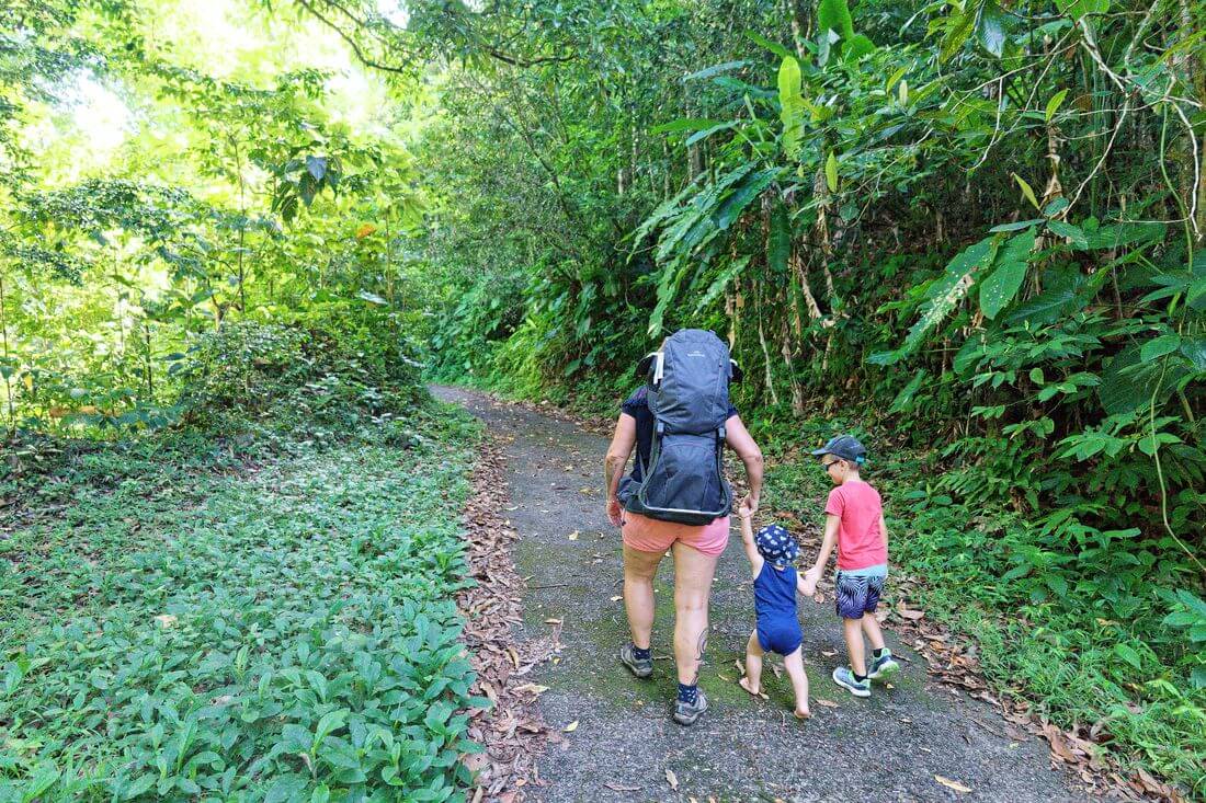


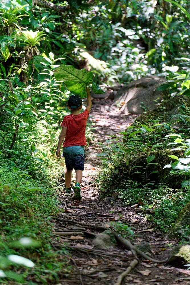
After crossing the river, we follow the marked trail to the right, deeper into the valley. The path narrows to single file and winds through a beautiful tropical forest filled with ferns, bamboo, and all kinds of other plants. I love taking in every detail while doing my best to capture it with my camera gear. From the dam onward, the route is well shaded, although much of the opening section is shaded too. Continue along this path for about 15 minutes, taking care not to miss the key junction. A large rock bears an arrow pointing right, indicating where you need to cross the river. From this point on, there is no way to stay dry: the water may reach your calves, or even your thighs if you are shorter. Once again, the crossing is manageable only when the current is not too strong and the water level is safe. If you have any doubts or see rain approaching, turn back and try the hike another day. Water levels can rise very quickly in this kind of valley, and accidents can happen just as fast.



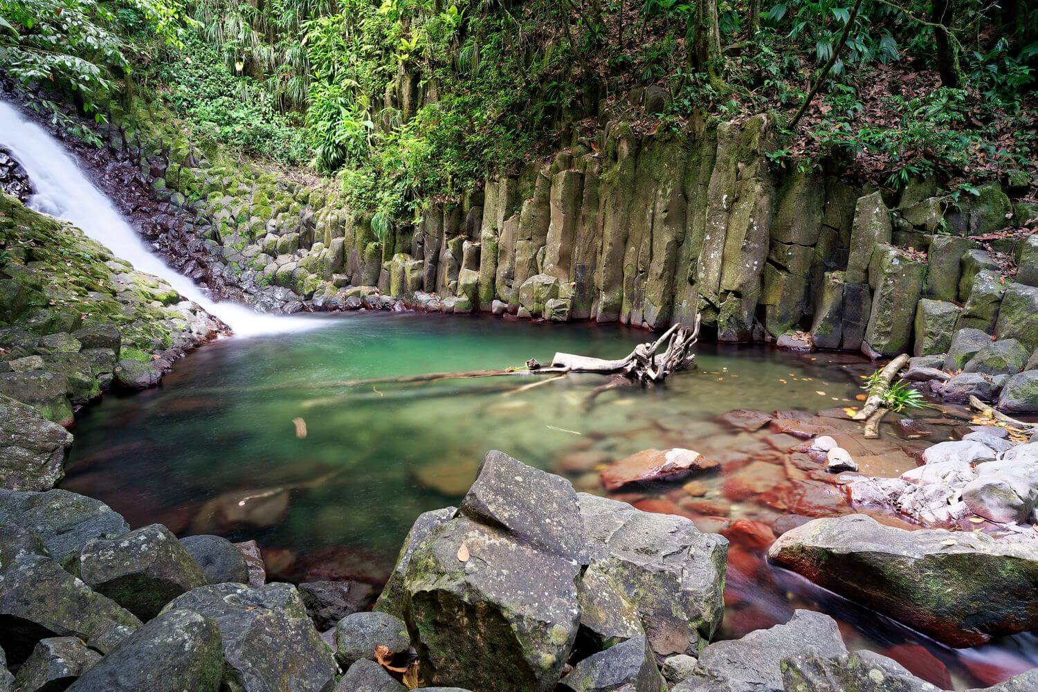
Once across, you will see a line of flat rocks on your right that looks almost like paving stones. Follow them downstream for about 50 meters. The trail then continues into the forest on your left and, within a few minutes, leads to a first pool of vivid green water at the foot of a waterfall. In the background, you can already see the famous Cascade du Paradis. On our first attempt, we had to hurry because night was closing in, but this time we arrive at this beautiful pool at 10:00 a.m. We have the peaceful place entirely to ourselves, and I can honestly call the setting paradise-like. We savor the moment as a family, far from everyone else. A quick dip in the deep pool reminds us that river water is not exactly warm—haha. I also take the opportunity to shoot a few long exposures.


We then continue up the trail toward the Cascade du Paradis itself, which is even more impressive. Water pours down the mountainside with considerable force. At the foot of the waterfall, beneath a towering volcanic rock face shaped like basalt columns, lies a beautiful turquoise-green pool. The setting feels even more special when you have it to yourself. We decide to eat beside the pool, although in hindsight that was not the wisest choice given the signs of rockfalls and the reports I later read. I would recommend resting on the opposite side instead, near the large rocks and away from the basalt columns. We spend a good hour having lunch in this enchanting spot, one that is difficult not to appreciate. The children are getting tired, so it is time to head back. The return goes smoothly, and we reach the car without any problems. Although the hike is not particularly difficult, we are still a little tired, and Louis is too.
If you enjoyed this walk, you may also love the hike to Chute du Galion, at the foot of La Soufrière. It is another beautiful route through Guadeloupe’s tropical forest.
Hike Summary
- Difficulty: little elevation gain, but two river crossings—one near the dam and another shortly before the waterfall. The route can be dangerous in wet conditions.
- Duration: about 1 hour 30 minutes each way, or roughly 3 hours round trip
- Length: about 5 km round trip
- Type: out and back
- Ideal: bring a small picnic for lunch
- Season: the dry season is preferable. Do not attempt the hike after heavy rain or when bad weather is forecast because of the two river crossings.
- What to bring: a rain jacket, proper shoes—no flip-flops—and mosquito repellent
The map below shows the location of the Cascade du Paradis hike. As you explore it, you can also see other hikes in the area. We have created a complete page about hiking in Guadeloupe if you would like more ideas. You can also download the hike’s GPS track in .gpx format using the link below:
What to do in the area?
I obviously do not know the area like the back of my hand yet. Based on my research and topographic maps, you can also:
- Explore the Beaugendre Valley
- Hike to Trois Crêtes or Piton de Bouillante
- Farther north, discover Saut d’Acomat waterfall in Pointe-Noire
Practical Information
Here is the practical information you need to plan this hike.
How to Get to Cascade du Paradis
First, of course, you need to get to Guadeloupe. When planning your trip, you can compare flights on Skyscanner, which I have used for more than 10 years to look for good fares. Features such as “Whole month” and “Cheapest month” can help you identify less expensive travel dates. Airfares vary widely depending on the season, airline, and departure city, so it is worth comparing several options. You can check fares from the United States here, and from Canada here. For more details, we wrote a complete article explaining how to get to Guadeloupe.
Once you arrive, renting a car is the most practical option. You can collect one at the airport or in Pointe-à-Pitre. I also recommend checking the car rental comparison service DiscoverCars, which compares rates from a range of rental companies.
Travel time to the trailhead naturally depends on where you are staying. It takes about 30 minutes from Saint-Claude (see the route). From the north via Route de la Traversée and the Mamelles road, allow around 45 minutes (see the route). In both cases, follow the Grande Rivière des Vieux-Habitants valley for about 6 km to the Habitation La Grivelière parking area. There is also a large pull-off slightly farther along on the left where we have seen several cars parked.
On a smartphone, the following apps and resources can be useful:
- Maps.me, which provides detailed offline maps,
- The Rando Guadeloupe app (Android / Apple), available in French. It includes many routes, including Cascade du Paradis, along with detailed information about local wildlife, plant life, and other points of interest,
- You can also download the complete track from the Wikiloc website.

Where to Stay After the Hike
There are several pleasant places to stay nearby after a day of hiking. These three are well regarded and conveniently located:
- L’Eden des Colibris: an attractive vacation home in a peaceful setting
- Peaceful House: another inviting home with sweeping views of the surrounding area
- Les écolo-gîtes de l’Habitation Laurichesse: a charming wooden property less than 2.5 km from Petite Anse Beach.
If you live in the area or know a good place to stay, feel free to leave us a comment. You can also browse more accommodations around Vieux-Habitants through this link. Farther along the west coast of Basse-Terre, we stayed at Jardin des Colibris in Deshaies and loved it.
That brings me to the end of our second hike in Guadeloupe, entirely within Guadeloupe National Park. We genuinely enjoyed it, and swimming in this beautiful setting made a refreshing change from white-sand beaches and coconut palms. The trail is pleasant, and the scenery at the waterfall is especially rewarding. It is a few hours of walking through a beautiful natural environment. If you have the time and are staying nearby, this is a very worthwhile hike. For an easier family outing, consider exploring Saut du Bras du Fort in Goyave. We also published a complete guide covering everything you need to know about hiking La Soufrière volcano.
See you soon for another walk. We cannot wait to discover more of Guadeloupe!

Written by Sylvain PONS
Since 2021, I've been living in the Guadeloupe archipelago with Mélanie and our two children. We are exploring these beautiful islands and discovering the treasures that we are happy to share with you!
Despite our care, a mistake may have slipped into this article. If you find any, please don't hesitate to let us know so we can correct it as soon as possible and keep our information up-to-date!