The best hikes in Tenerife
Last update: 06/21/2026
Our blog continues to grow thanks to you, our readers. This post may contain affiliate links, which means we can earn a small commission if you make a purchase through them, at no extra cost to you. This helps us to continue to bring you more and support our work!
I couldn’t write about the largest of the Canary Islands without dedicating an entire article to the best hikes in Tenerife. The island is a fantastic playground for hikers, with trails for every level. I’m thinking in particular of Teide National Park and Anaga Rural Park, where you’ll find some of the island’s most beautiful routes, not to mention the Masca area in the Teno Mountains. What makes hiking here so rewarding is how dramatically the scenery changes from one area to the next, from stark lava fields to lush mountain peaks. That variety is one of Tenerife’s greatest strengths: the landscapes are far more diverse than you might expect. It surprised me, and it’s one of the reasons I fell in love with this beautiful island.
Needless to say, hiking is one of the must-do activities in Tenerife. Even if walking isn’t usually your thing, some trails are very accessible. A few are also much less well known than others, which makes for a quieter and more enjoyable experience. So, without further ado, here are the best hikes to do in Tenerife. Unless you plan to hike every day, fitting them all into a one- or two-week trip would be difficult. This article should help you narrow down your choices and pick the routes that appeal to you most.
Must-do hikes in Tenerife
Let’s begin with Tenerife’s must-do hikes—the trails that truly deserve a place on your list. Some are well known and fairly busy, while others remain quieter and are ideal for hiking in peace. One quick tip before you set out: bring the right gear and check the weather forecast, as Tenerife’s microclimates can make conditions change quickly. Now, let’s explore some of the island’s most beautiful trails!
Volcanic and high-altitude hikes in Tenerife
You can’t talk about hiking in Tenerife without mentioning the trails in Teide National Park. Beyond the climb to Mount Teide’s summit, there are several other routes through equally varied landscapes. I’ll cover trails both inside the park and around its edges. If this is the part of the island that interests you most, we recommend staying in northern Tenerife.
Pico del Teide
Unsurprisingly, we’re starting with the most famous hike on the island. If you make it all the way to the top, you’ll reach Spain’s highest peak at 3,718 meters above sea level—not bad at all. This is a demanding hike, but both the route and the summit make the effort worthwhile. Along the way, you’ll cross striking volcanic landscapes. Allow around five to six hours to reach the summit from the Montaña Blanca parking area.

You can also take the cable car and complete only the final section on foot. This is much easier, although the last stretch to the summit is still steep. Keep in mind that you need a reservation to access the Telesforo Bravo trail between the upper cable car station and the peak. Once you arrive, take your time and enjoy the sweeping view. You may find yourself above the clouds, with neighboring Canary Islands such as La Palma or La Gomera visible in the distance.
Montaña Guajara
Directly across from Mount Teide, Montaña Guajara also offers magnificent views from an elevation of 2,718 meters. From the top, you’ll look out over Teide and the surrounding lava fields. The trail is also considerably easier than the climb to Teide’s summit. It starts near the Parador de Las Cañadas del Teide and rises gradually through an almost lunar landscape.
Allow between three and five hours for the round trip—roughly half the time needed for Teide’s summit. There is some elevation gain, but the hike remains moderate overall. I recommend starting early, before the temperature rises, although that will depend on the season. Personally, I think it’s an excellent alternative to summiting Teide: it takes less time and effort, haha.
Roques de García
This is one hike you shouldn’t miss in Teide National Park, even though most visitors stop at the viewpoint. In a way, that works in your favor: the trail is quieter, you can walk at your own pace, and you’ll have more time to enjoy the views of Teide and the enormous rock formations.


I also liked that the route forms a loop beginning at the Mirador de la Ruleta, opposite the park’s restaurant and its large parking area. In truth, it feels more like a walk than a hike, as there is very little elevation gain. The main challenge is the heat because shade is scarce. Other than that, it’s very manageable!
Sámara
Although it’s less well known than some of the park’s other trails, this one is absolutely worth the detour. For me, it was one of the park’s best surprises—and that’s saying something! The route lies in the far southwest of the park and offers superb views of Teide and Pico Viejo. It’s also a loop, which I always find more interesting because the scenery keeps changing as you go.

Starting from the Mirador de Sámara, you’ll cross lava flows dotted with Canary Island pines and volcanic cones in shades of ocher, black, and red. The scenery is incredible. The trail ranges from easy to moderate, and what I love most is its balance of beauty, tranquility, and accessibility. You don’t need to be an experienced athlete to enjoy it—just bring sturdy shoes, water, and a little motivation.
Chinyero
Leaving Teide National Park, we head toward its western edge and the Chinyero volcano, the site of Tenerife’s most recent eruption in 1909. I had hoped to hike the loop around the volcano, but I ran out of time and had to make a few choices. That’s often how vacations go: you make a plan, then rarely follow it to the letter. As far as I’m concerned, this hike is simply postponed until next time!
The landscapes along the route look remarkable, with black lava flows, Canary Island pine forests, and red and gray volcanic soil. There’s something special about walking across the traces of an eruption while watching vegetation gradually reclaim the land.
Another advantage is that the area is rarely crowded, so you can enjoy the scenery almost alone—or at least with very few people around. In clear weather, you’ll also be rewarded with beautiful views of Teide. Better still, the hike is considered easy to moderate.
Paisaje Lunar (Vilaflor)
The Paisaje Lunar hike begins in the village of Vilaflor de Chasna. Its name literally means “lunar landscape,” and it certainly lives up to it. The trail first passes through a Canary Island pine forest before reaching the famous pale rock formations sculpted by wind and erosion into chimneys and small cones. The contrast between the light-colored stone and the green pines is beautiful.
Once again, this is a relatively little-known hike. I hadn’t heard of it before traveling to Tenerife, which means you can usually walk here in peace. To me, that only adds to the area’s wild, untouched atmosphere.
Hiking trails in Anaga’s forests
I mentioned it briefly at the beginning of the article, but Anaga Rural Park is the greenest part of the island and is often described as Tenerife’s green lung. It is also a UNESCO Biosphere Reserve. The scenery feels completely different from the rest of Tenerife, with laurel forests and subtropical vegetation. I had heard about Anaga before my trip, but I still wasn’t prepared for just how surprising it would be.
Sendero de los Sentidos
The Sendero de los Sentidos, or “Path of the Senses,” is both the most accessible and the most popular trail in Anaga Rural Park. It starts at the Mirador de Cruz del Carmen, where there is a convenient parking lot that tends to fill quickly. As the name suggests, the route encourages you to use your senses—hearing, touch, smell, and sight. It’s an easy yet engaging walk through the forest, with interpretive information along the way. This is a great option for families with children.

Naturally, the trail can get busy, but I was lucky enough to arrive after the largest wave of visitors, so the crowds didn’t bother me. The temperature is also cooler and more pleasant beneath the trees. The walk takes no more than an hour, which felt almost too short—I would happily have stayed longer, haha.
Punta del Hidalgo
Punta del Hidalgo lies at the edge of the Anaga massif, where the mountains meet the Atlantic. It’s a distinctive setting of cliffs, steep slopes, and crashing waves. The route down to Punta del Hidalgo is often considered one of the most beautiful hikes in Anaga Rural Park. I haven’t had the chance to do it yet, but the variety of landscapes looks remarkable.
The trail alternates between dense forest, small hilltop villages, and drier terrain, revealing just how many microclimates can exist within a single part of Tenerife. Reaching Punta del Hidalgo should be a rewarding finish, with wide coastal views and natural pools nearby if you feel like taking a dip. In my opinion, this route captures Tenerife’s diversity especially well. It’s firmly on my list for my next visit.
Tenerife’s ravines and gorges
Tenerife’s hiking variety also extends to its barrancos, the deep ravines carved by erosion over time. These routes feel very different from forest trails or volcanic landscapes. Here, you’ll walk through enclosed valleys—sometimes lush, sometimes arid—surrounded by cliffs and rock walls. I couldn’t include every ravine on the island, of course, so I selected a few of the most impressive ones.
Barranco del Infierno
Barranco del Infierno means “Hell’s Ravine.” Based on the name alone, I expected a deep, dry, rocky gorge. In reality, it’s surprisingly green, well maintained, and carefully managed, with a waterfall at the far end of the route. It’s one of the island’s best-known ravines, and advance booking is required because daily access is limited.
The scenery changes beautifully along the way, from steep cliffs to the dry vegetation typical of southern Tenerife. The landscape feels wild while remaining unmistakably characteristic of this part of the island.
Barranco de Masca
Barranco de Masca is another very popular—and particularly impressive—ravine. I had heard plenty about it before my trip, but seeing it in person still made a strong impression on me. The gorge surrounds the village of Masca, which sits dramatically between the mountains. You can already appreciate the scenery from the Mirador de Masca, several kilometers before reaching the village. Even the drive there feels like an adventure, with a narrow, winding road and steep drops along the side.


And then there’s the traffic. I strongly recommend arriving around 8 a.m. for a calmer drive and a more enjoyable visit. When I went, someone was managing traffic and parking near the viewpoint, which helped. With so many cars starting on the steep incline, you could even smell the exhaust. Still, the panorama is well worth the effort: the viewpoint overlooks the entire ravine, with Masca perched in the middle. Even if you don’t hike the gorge, I recommend stopping here for the view.
Barranco de Ruiz
Barranco de Ruiz, between San Juan de la Rambla and Los Realejos, was a lovely discovery in northern Tenerife. It’s a quiet place, and there wasn’t anyone else around when I visited. Fog covered the upper slopes, so I couldn’t fully appreciate the scale of the valley, but I still enjoyed the atmosphere. It gave the landscape a mysterious quality that made for a pleasant change.

The climb is short and straightforward, with a well-built staircase leading to the viewpoint in just five to ten minutes. Take a little extra care along one brief section where the ground is less stable and there may be a minor rockfall risk. You pass through it quickly, though. Another advantage is the parking area at the foot of the ravine, which makes access very convenient. This is an ideal quick stop for enjoying a panoramic view without committing to a long hike, or for taking a nature break between visits in northern Tenerife.
Coastal trails and cliffs in Tenerife
Tenerife is about far more than volcanoes and forests, so let’s head to the coast, where the ocean meets towering cliffs. I loved these landscapes too, as they revealed yet another side of the island. Along these routes, you’ll pass seaside villages, palm trees, banana plantations, and volcanic cliffs plunging into the Atlantic.
Rambla de Castro
Rambla de Castro is one viewpoint you shouldn’t miss. I had already visited on my first trip to Tenerife, but I was just as impressed the second time. To me, it perfectly captures the beauty of the island’s north, with palm trees, black volcanic rock, terraced banana fields, and a broad view over the coastline and ocean. Honestly, it was a real wow moment on both visits.

From the top, a trail descends gradually through the banana plantations. The paths can feel almost maze-like, but the setting is beautiful and immersive. Because the route is fairly steep, the climb back up is demanding—that’s the main drawback, though it’s also part of the experience. Your thighs and calves will definitely feel it. Allow around two hours for the round trip.
Mirador de Los Gigantes
Let me reassure you right away: this viewpoint is easy to reach from the port of Los Gigantes. There is a short climb, but it takes no more than about fifteen minutes. From the top, you’ll have a magnificent view of the immense Los Gigantes cliffs, which seem perfectly positioned along the edge of the ocean. This viewpoint really gives you a sense of their scale.
The viewing platform has large transparent glass panels overlooking the drop below. From there, you can see the port and the well-known Playa de los Guíos. One tip: visit near the end of the day in clear weather to watch the sunset. The view must be beautiful.
More hikes in Tenerife
To round out this guide, I wanted to include a few quieter hikes that deserve more attention. You’ll generally find far fewer people on these trails, so this section should appeal to anyone looking to get off the beaten path.
Benijo - Cruz del Draguillo
This hike crosses part of Anaga through striking scenery that combines cliffs, ocean views, remote villages, and lush vegetation. The route starts near Benijo Beach, one of Tenerife’s wildest and most beautiful beaches, and continues toward Cruz del Draguillo, a small hamlet in the mountains. Before setting out, check the current trail status on Tenerife ON, as sections may be restricted or closed for safety reasons. Access to Benijo Beach itself has also been subject to safety closures. Unfortunately, it was closed when I visited, but hopefully conditions will allow you to explore the area.

Las Carboneras - Chinamada - Mirador Aguaide
Here is another hike tucked away in the Anaga massif. The route feels wild and unspoiled, with panoramic views along the way. It links the villages of Las Carboneras and Chinamada before reaching the Mirador de Aguaide, one of the area’s most beautiful viewpoints. The walk begins in a mountainous landscape of laurel-covered hills and ferns, then reaches the small hamlet of Chinamada. The village is peaceful, and you’ll mostly encounter local residents. The final reward is the Mirador de Aguaide, with a dramatic view over the ocean and cliffs. Allow between three and four hours for the round trip.
Taborno - Roque de Taborno - Mirador Barranco la Fajana
Still in Anaga Rural Park—I told you it was a hiker’s paradise—this beautiful route circles Roque de Taborno, often nicknamed the “Machu Picchu of Tenerife.” That gives you an idea of the setting. Along the trail, one panoramic view follows another, overlooking the mountains, ocean, and ravines.
Roque de Taborno is a massive rocky peak rising above the surrounding valley. If you follow the full loop, you’ll also pass the Barranco de la Fajana and several viewpoints. Allow between two and two and a half hours to complete the circuit. The hike is generally easy to moderate, although a few exposed sections may feel uncomfortable if you’re sensitive to heights.

Callejón de Teno - Baracán summit
As the name suggests, this route takes us into the Teno massif and up toward the summit of Baracán. Along the way, the scenery combines mountains, ocean views, and picturesque villages. A new viewpoint seems to appear around every bend, and the changing panoramas help distract from the steeper sections.
The route begins near Callejón de Teno, a small mountain settlement close to Baracán at more than 1,000 meters above sea level. The difficulty ranges from moderate to challenging, depending on the section. The views make the effort worthwhile: on one side lie the Teno Mountains and the El Palmar Valley; on the other, the ocean and, in clear weather, the neighboring island of La Gomera.
You now have a complete overview of the best hikes in Tenerife, and I’m fairly sure at least one has already caught your attention. At least, I hope so! You won’t be able to fit them all into a single trip, but you can easily include a few in your Tenerife itinerary.
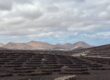
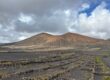
You may also enjoy our guide to the best hikes in Lanzarote. That island has plenty of surprises of its own, with landscapes that feel quite different from Tenerife.
See you again soon for more things to do in Tenerife!

Written by Laura CALLES
Thanks to Mélanie and Sylvain, I had the chance to discover the Canary Islands, specifically Tenerife and Lanzarote, so that I could share these island paradises with you. Two real favorites of mine!
Despite our vigilance, an error may have crept into this article. If you spot one, please don't hesitate to let us know so that we can correct it immediately and keep our information up to date!